| | |||||||||||||||||||||||||||||||||||||||||||||
| Shetlands Bike Trip
This was a cycling trip with Andrew, aimed at riding to the end of civilisation - ie to the end of the most northerly road in the UK. This appeared to me to be a cart-track on the isle of Unst leading past Saxa Vord on the way to a fairly remote headland, The Noup. The trip started on Monday 26th with me packing the bike in the car and driving up to Ramsbottom to spend the night at Andrew's.
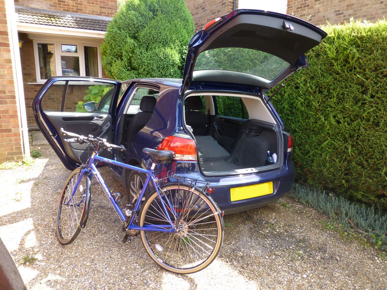
Tuesday 27th August 2013 - Ramsbottom to the ferry We left Ramsbottom at about 08.26 and drove up to Aberdeen, getting there at about 3.15 pm (352 miles). Having unloaded the bikes we left the car in a free car park in Viewfield Road - I'd looked at it with Google Streetmaps and the area looked ok - and rode the couple of miles to the docks through a fairly busy town centre.
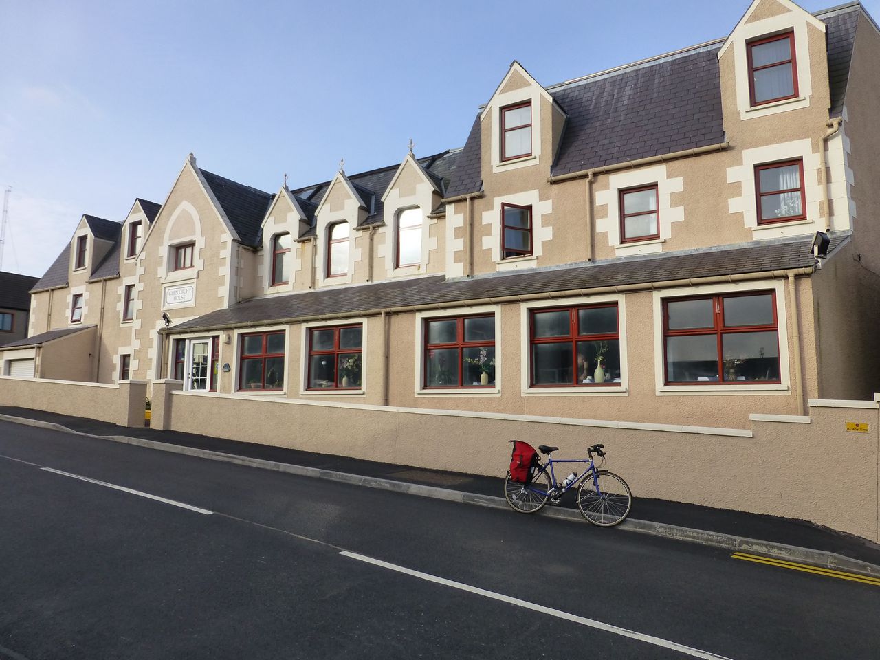
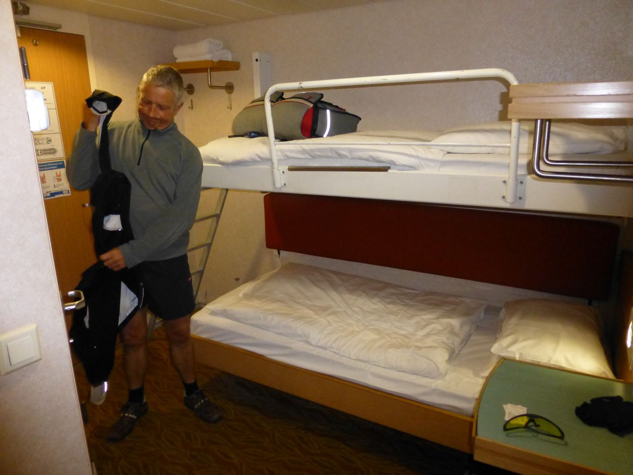
We were supposed to check in by 4.00 pm for a 5.00 sailing and the confirmation email had said we would need a copy of the email and some photographic ID. That seemed a bit over the top for a trip to the Shetlands but we both had some suitable ID which in the event proved completely unnecessary. We arrived at the check-in gate at the docks and before we could even say a word the attendant there said simply, 'Ah you must be Mr Thomas.' Apparently we were the only two cyclists booked for that day and our having turned up on bikes was enough. We weren't asked to show anything, we were just handed our tickets and waved aboard - and as it was nearly 16.00 by now we were told we didn't have time to stop and take a photo of the ferry, we had to board straight away. The ship was the Northlink ferry MV Hrossey. Wednesday 28th August 2013 - Lerwick to Sumburgh Head and back The day started with a wake-up call on the ship's tannoy at 6.30, telling us we'd be docking at 7.30 so could we shift ourselves and buy some of their tasty breakfasts. Accordingly we got down to the breakfast bar by about 7.00 and both Andrew and I had the continental breakfast for about Ł6.50. It was ok except for the bread rolls which were stale and hard - and white. Once off the boat we decided to find the night's B&B, the Glen Orchy Hotel, and dump most of the luggage so we wouldn't have to cart it around with us all day. The bloke manning the reception desk at the hotel was an old boy called Trevor, from Kirkby Lonsdale who told us he'd been there for 45 years. When he started on, in an amicable enough way, about cyclists not paying 'road tax' I had a bit of dialogue with him to try and enlighten him that there was currently no such thing as road tax and hadn't been since 1937! I may have ranted slightly but all was ok.
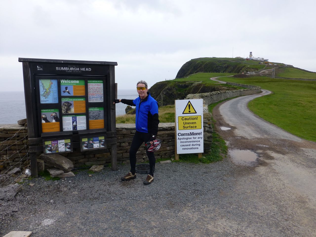
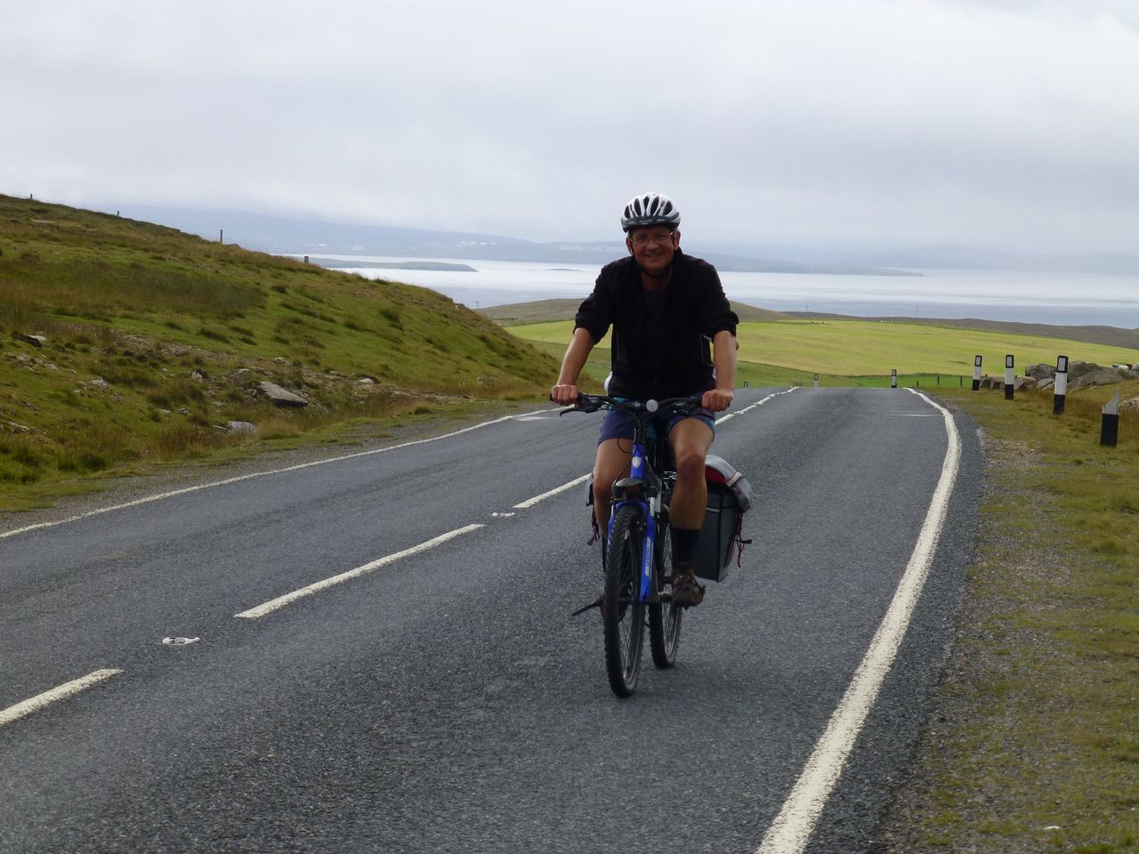
Finally we were ready to leave whereupon Andrew decided it was a good time to fix an annoying clicking noise on his bike by adjusting his front derailleur - it has 2 adjusting screws like all of its kind. His innate mechanical skills inevitably resulted in the front gear change quickly becoming completely inoperable so we then had to faff about taking his bike to a local bike shop. Trevor gave us directions which didn't work but eventually we located the shop and the nice lady there whipped out a screwdriver and fixed Andrew's bike in about 60 seconds, kindly refusing any payment for doing so. After that we faffed about a bit more looking for a new battery for my bike computer but eventually we managed to get underway. This first day proved to be quite demanding, being a bit more hilly than I'd thought. It was mild, cloudy/overcast and there was a bit of a headwind against us as we rode south towards Sumburgh Head at the bottom of Mainland. There's a lighthouse there but this was being renovated at the time so we didn't go up to it.
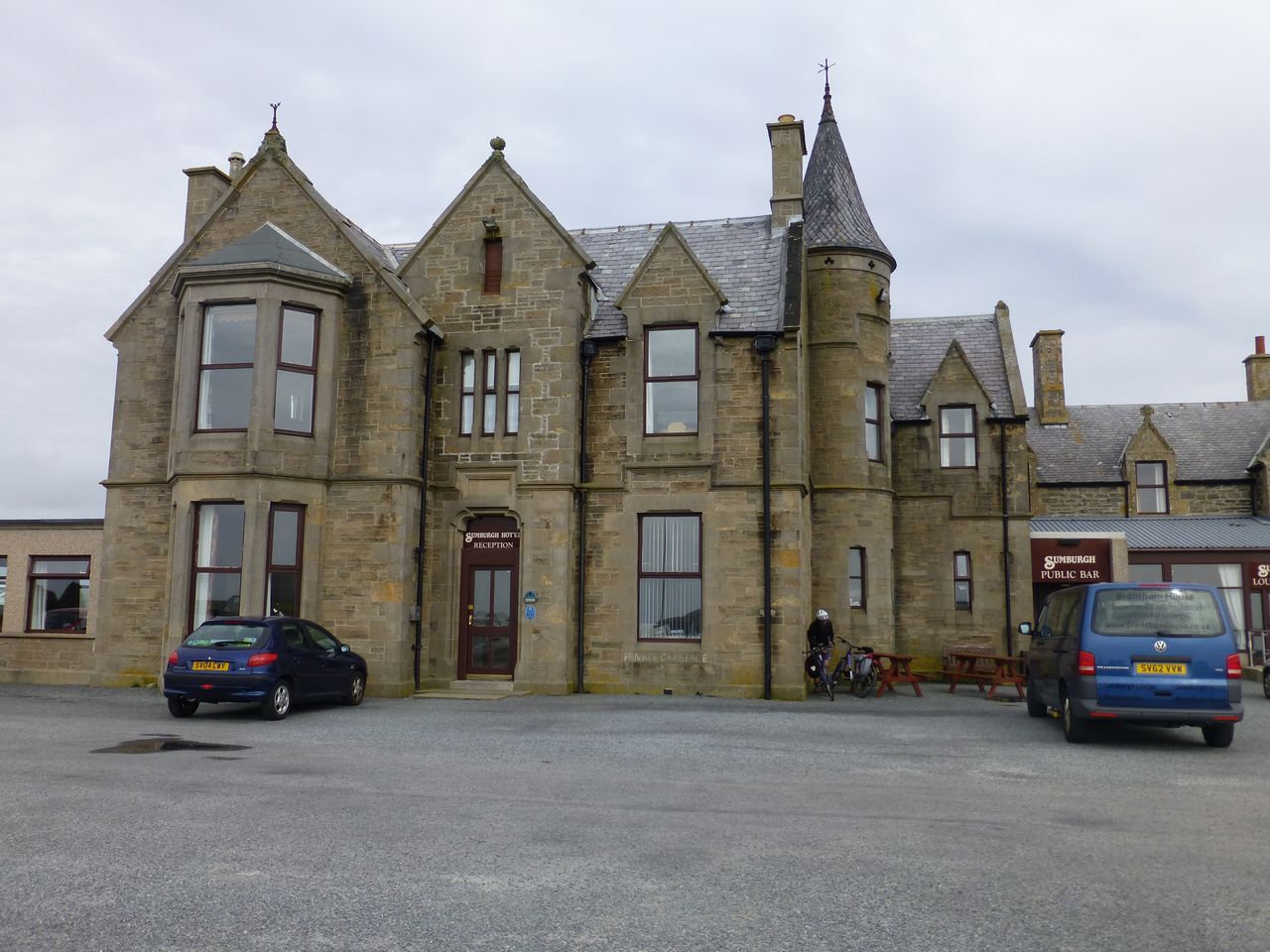
We looked in vain for the whales which the information sign said liked to disport themselves off the headland then gave up and rode back through someone's farm track to the Sumburgh Hotel - a big, solid, gothic, typically Scotch stone pile - and had a bit of lunch. Egg and cress sandwich, bit of salad and a few crisps, plus a cup of tea. On the way down to Sumburgh we'd also diverted briefly to Sandwick where we'd had a bit of carrot cake and a cup of tea at the tourist info/café place there.
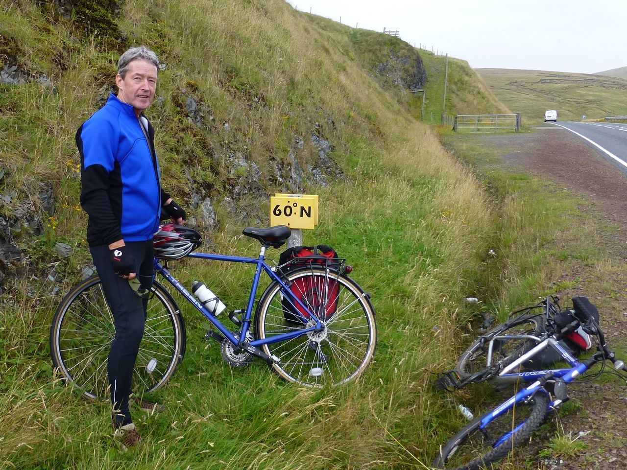
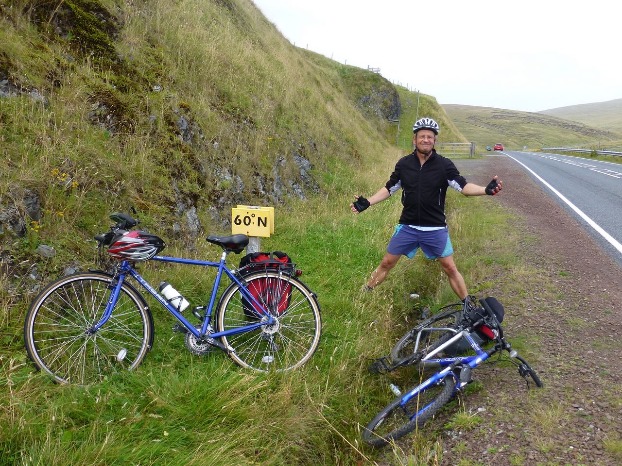
We headed back to Lerwick and along the way noticed a small yellow sign stuck in the verge of the road; it said simply '60° N'. Well we couldn't ignore that so out came the camera and photos were taken for posterity showing us crossing the 60° N line of latitude - we were now as far north as Alaska and Greenland!
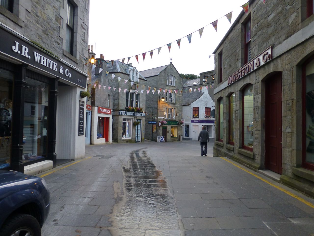
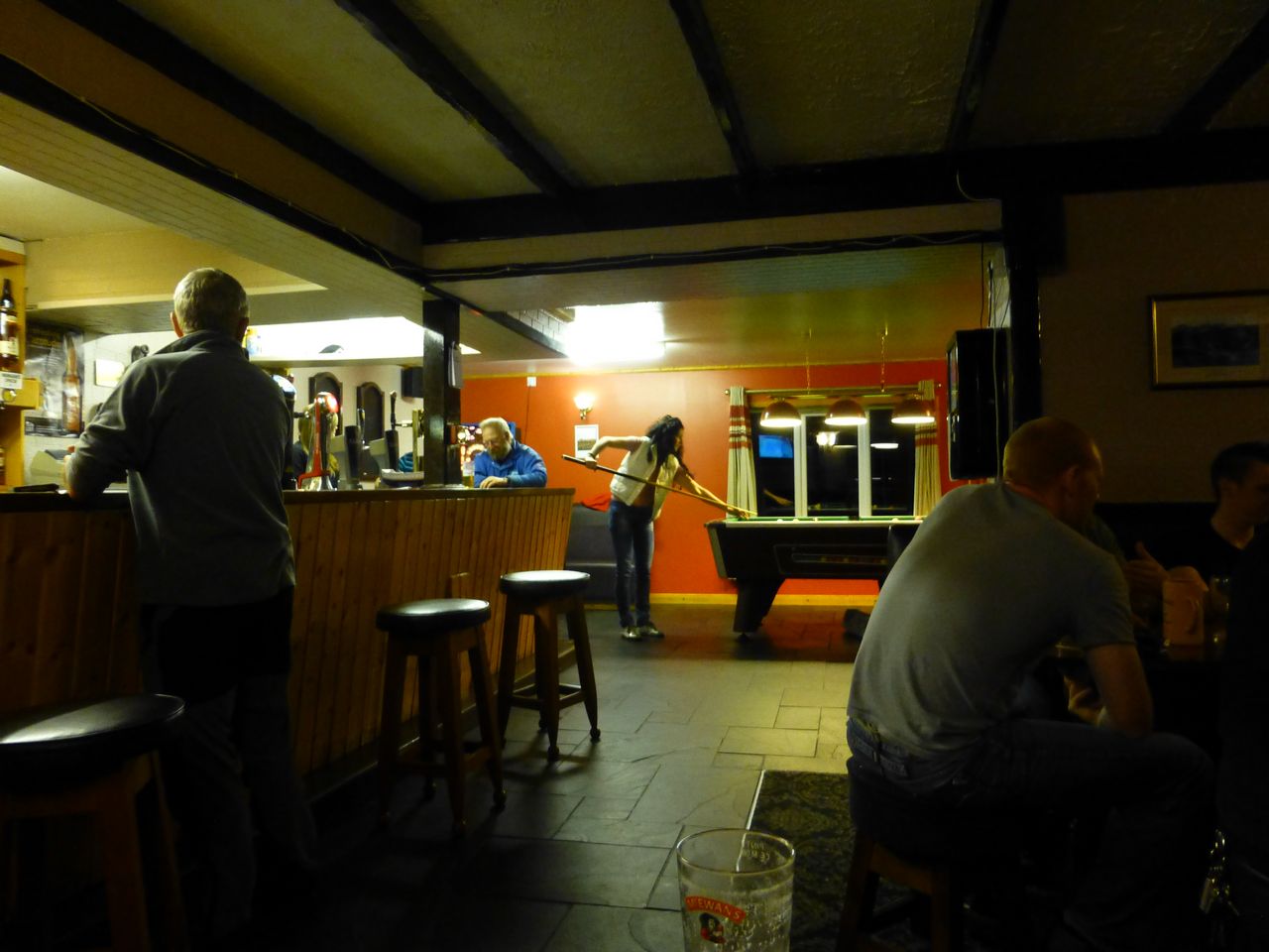
We carried on and started to flag a bit with the hills and the wind but finally arrived back at Lerwick ok. In the evening we ventured out for some food and drink but there was little on offer - Lerwick didn't seem very geared up for tourists. We ended up at an Indian restaurant called Raba. It was ok but the Indian food, as it does sometimes with me, filled me up to bursting point, to the point where it was difficult subsequently to drink a pint of beer. As it happened there wasn't much about the Lerwick pubs to encourage you to drink. The first one we went in was 'Da Wheel'. 'Da' is the local Shetland dialect for 'the', nothing to do with rappers or gangsta music and all that rubbish. The only beer in this bar was lager or John Smiths. I had a pint of John Smiths and apart from it being difficult to get down because of the food and my distended stomach, it was just horrible. I lost every dominos game and 2 games of pool too. The clientele in Da Wheel were of the lower ranks of humanity, whose every other word was a swear word - mostly F… & C….
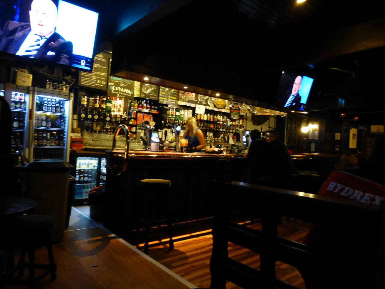
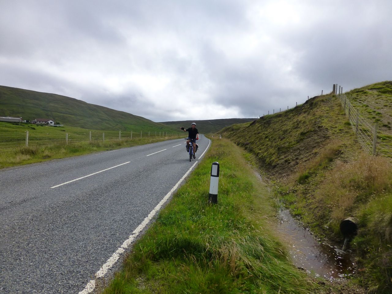
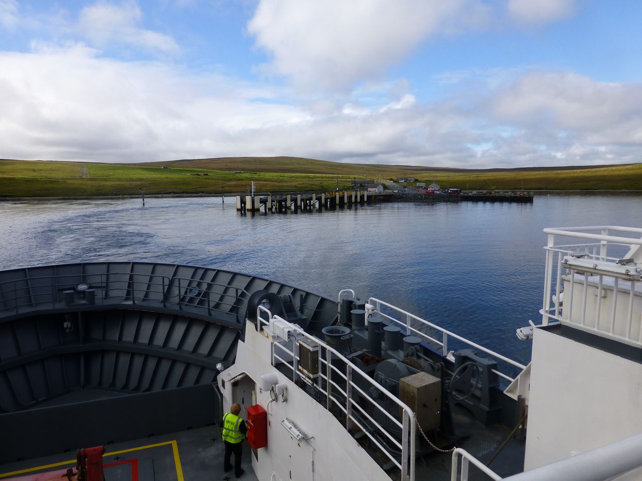
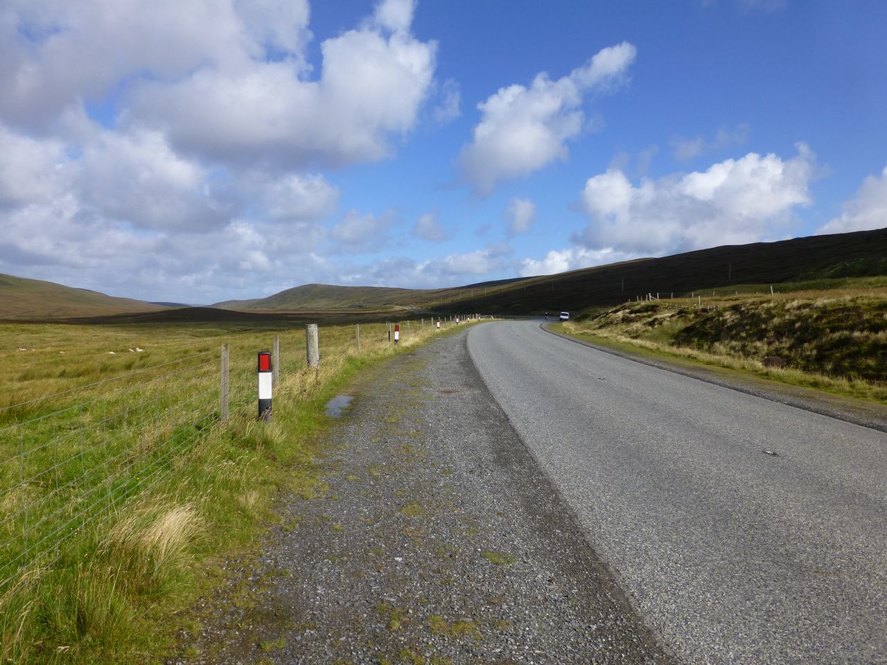
From Da Wheel we wandered off to Captain Flint's, a seedy pub which had been full of bikers earlier when we looked in. We went back to it because a sign outside promised it had 'real ales' on offer. Well it did, sort of. At least we were served up with something masquerading as such but they were awful - I left mine. Also the place was throbbing to the ghastly over-amplified strains of what passes for music these days. Awful. Stats for the day: GPS: 59.4 miles (including some faffing about in Lerwick) 9.1 mph average speed 38.6 mph max speed 4973 feet of ascent Bike computer: 54.65 miles (excluding the faffing) 10.4 mph average speed 38.5 mph max speed Thursday 29th August 2013 - Lerwick to Baltasound Quite a hard day. The starting stretch out of Lerwick was horribly steep and had to be attempted with cold muscles and just after stuffing as much breakfast into our stomachs as possible. A very difficult climb out of town and random thoughts of just jacking it in and getting the ferry home wafted through my brain. Maybe I was just feeling a bit drained from the previous day's exertions but drained or not I found myself in bottom gear very early on on the hill and it came as something of a shock when I couldn't select a lower one no matter how much I stabbed at the gear-lever. Still we ground on and eventually we plateaued and then were able to carry on, with a few ups and downs, as far as Toft where we were just in time to catch the ferry (Ł5 return but that included the Yell-Unst ferry both ways as well)
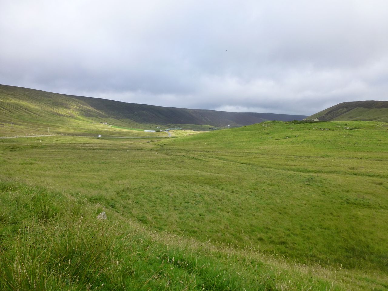
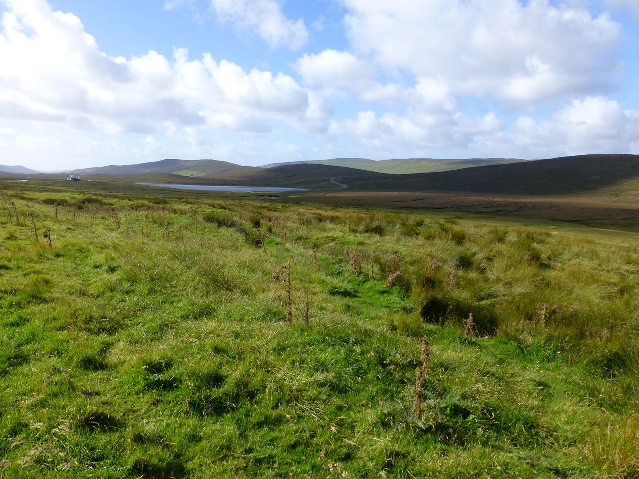
The weather was mostly dry until Yell but with low, dismal cloud not very much higher than ourselves, sometimes more or less lower. The landscape we passed through was bleak and uninspiring - low, rounded hills covered in grass, bog and bits of heather. There were virtually no trees to provide variation from the monotonous rolling shades of green and brown. Unfortunately there were a fair number of midges about but I didn't get bitten - I did spray my exposed bits with midge repellant as a precaution. Cycling through one particular stretch approaching Toft the midges were like a cloud of particles hanging in the air, impacting my cycle glasses, helmet, body, everything as I rode through them.
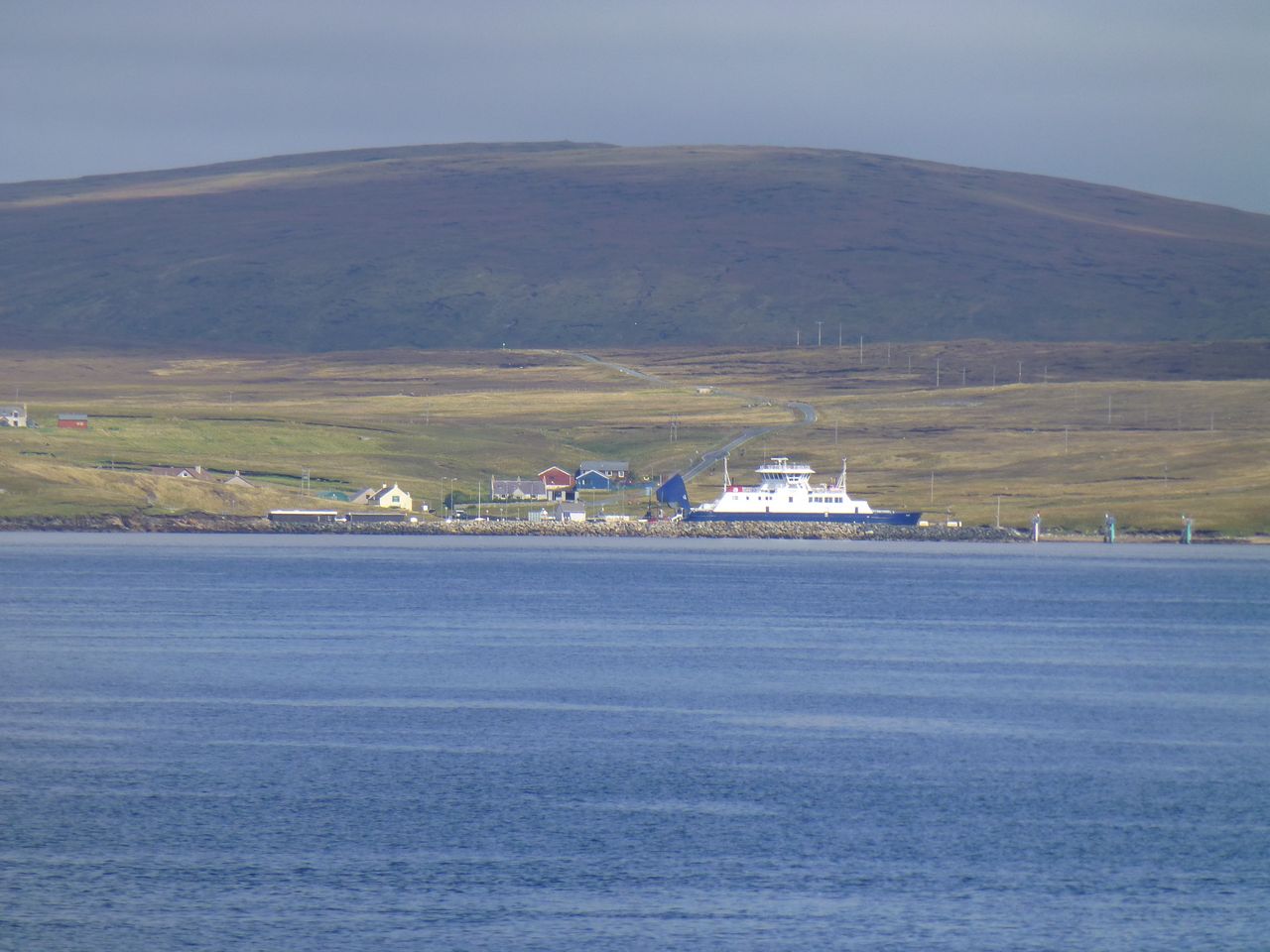
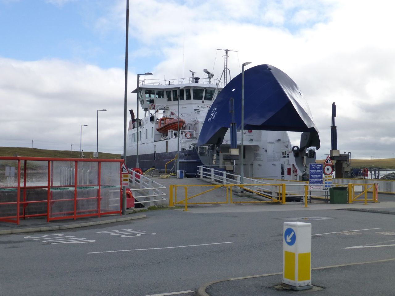
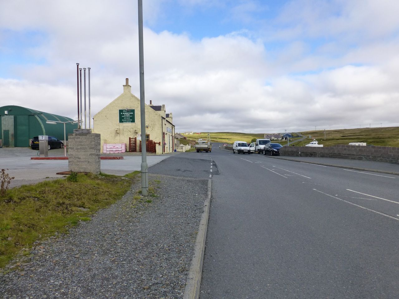
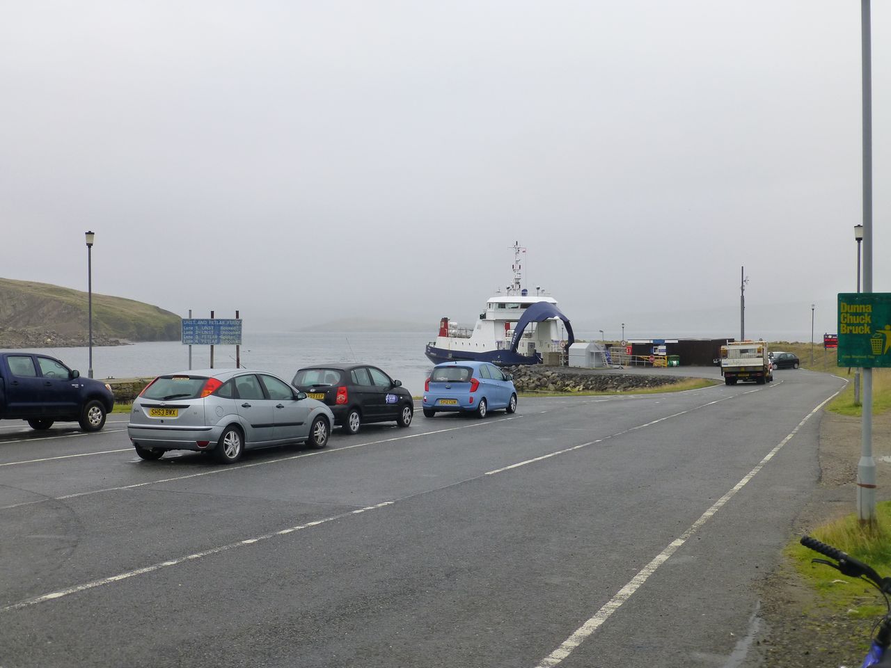
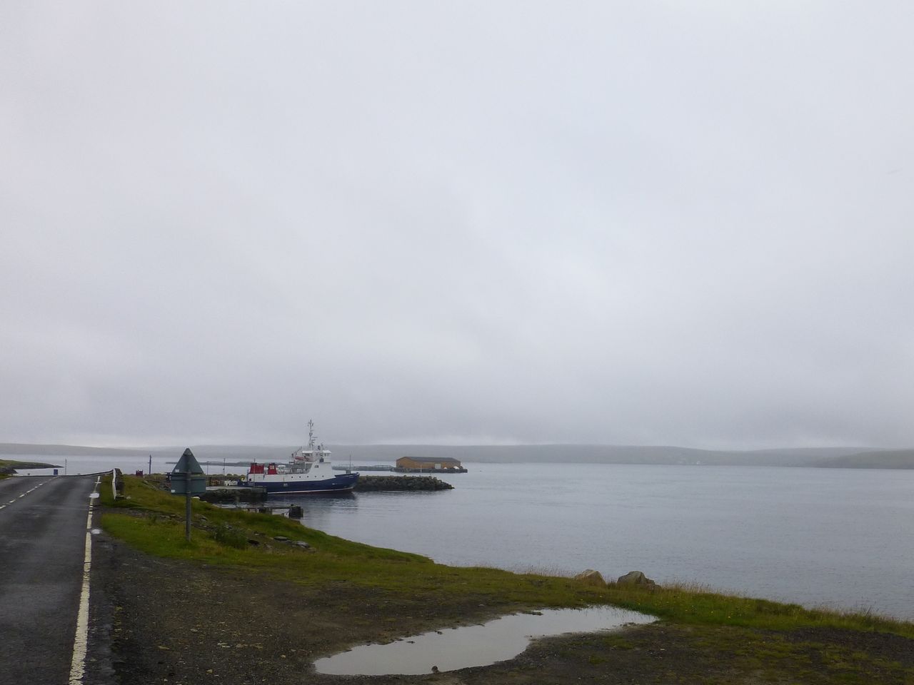
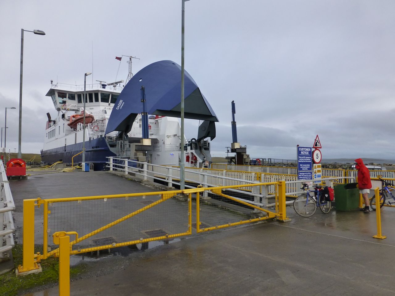
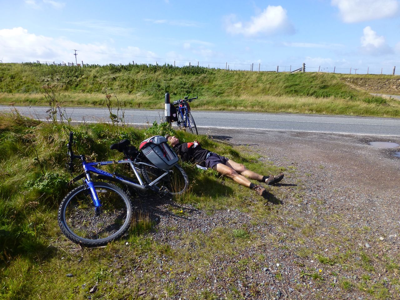
We got the ferry from Toft to Ulsta on the isle of Yell, the ferry being the MV Dagalien. It was a short voyage and at the other side there were one or two buildings including a store where we bought some rolls, cheese and tomatoes and a packet of crisps then sat on a wall nearby eating them.
Suitably refreshed we set off and rode the 17 miles to Gutcher to catch the ferry for the isle of Unst, the most northerly inhabited island in the UK. We had 20 minutes to wait before the ferry left so we had a cup of coffee in a café there, and a bit of carrot cake. The café was fairly isolated, just one or two other buildings nearby, and probably depended for all of its custom on ferry passengers. One of the waitresses there was from Wolverhampton; she was only in her early twenties and said she'd been in the job for 4 months - goodness knows why she'd ended up there. The ferry, the MV Fivla, took us the short hop across to Belmont on Unst; there was intermittent drizzle in the air by now and I'd donned my overshoes and waterproof jacket.
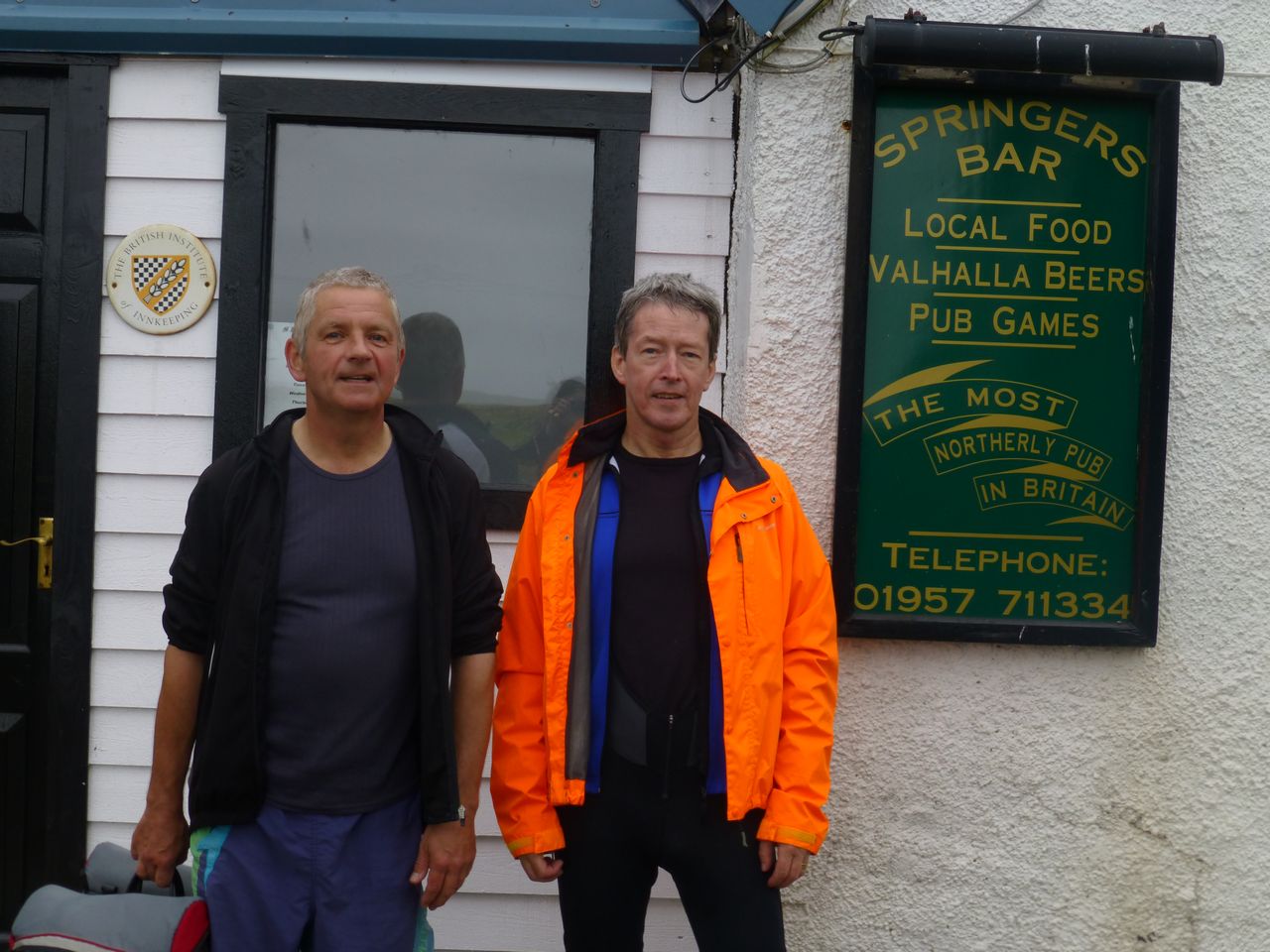
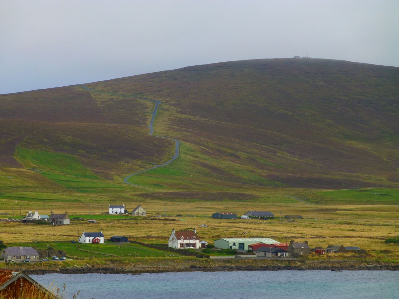
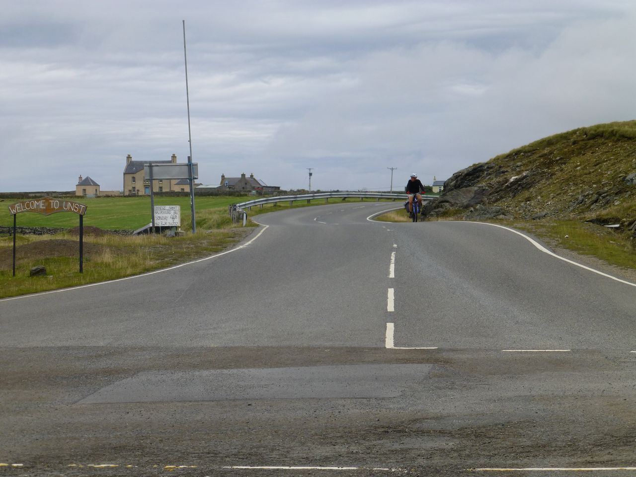
From Belmont to Baltasound, our destination, was only 9 miles and it was fairly straightforward. Baltasound turned out to be a very strung-out settlement, not very large but widely spaced. We found our way to the Baltasound Hotel (Ł89 for a twin room in a chalet outside the main stone-built building). It had a sign outside the bar saying that it was the most northerly pub in the UK.
There are quite a lot of 'most-northerlies' around there. Apart from the most northerly bit of road the next day we passed the most northerly brewery (the Valhalla Brewery) and the most northerly post box. We ate in the hotel (the only alternative would have been 4 miles away) then had a pint or two in the bar. Fairly quiet in there but a few locals were in and someone was playing pool.
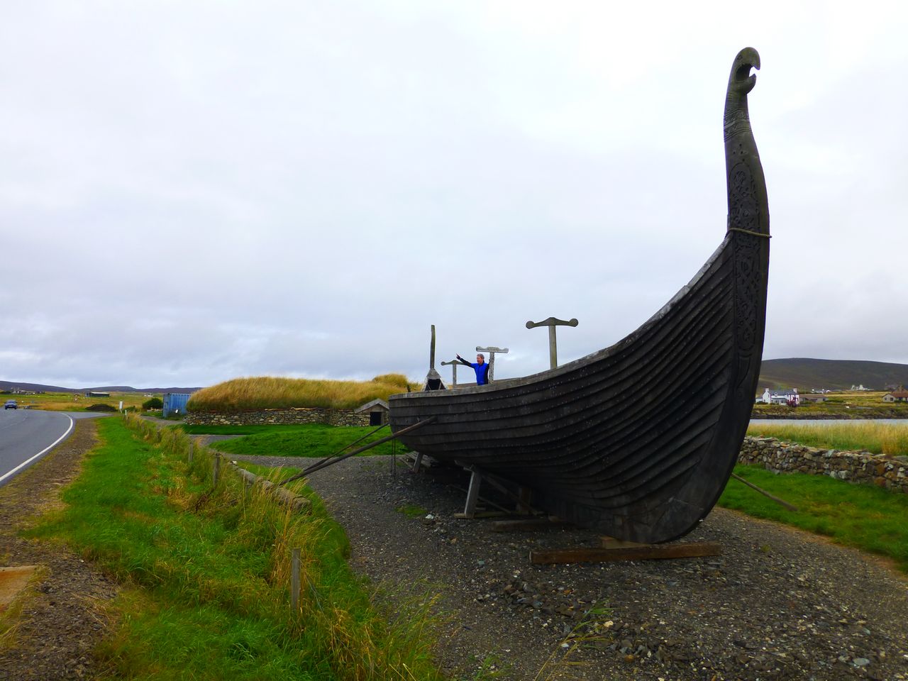
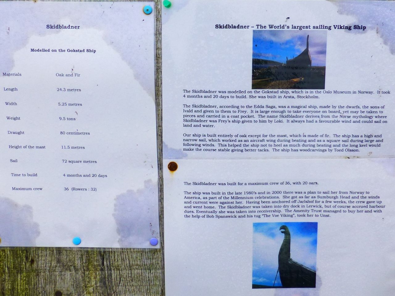
Stats for the day: GPS: 59.3 miles 10.3 mph average speed 4.1 mph max speed 3914 feet of ascent Bike computer: 54.52 miles 10.5 mph average speed Friday 30th August 2013 - Baltasound to Brae To make the morning easier we left the luggage at the Baltasound Hotel and cycled north to the Noup. On the way we passed a full-size Viking longship by the side of the road: the Skidbladner. It was a bit of a surprise to find such a thing there in pretty much the middle of nowhere, with absolutely no-one around, no tourist ticket sales or anything. All there was was the printed notice shown below, which tells the interesting tale of how the boat came to be there.
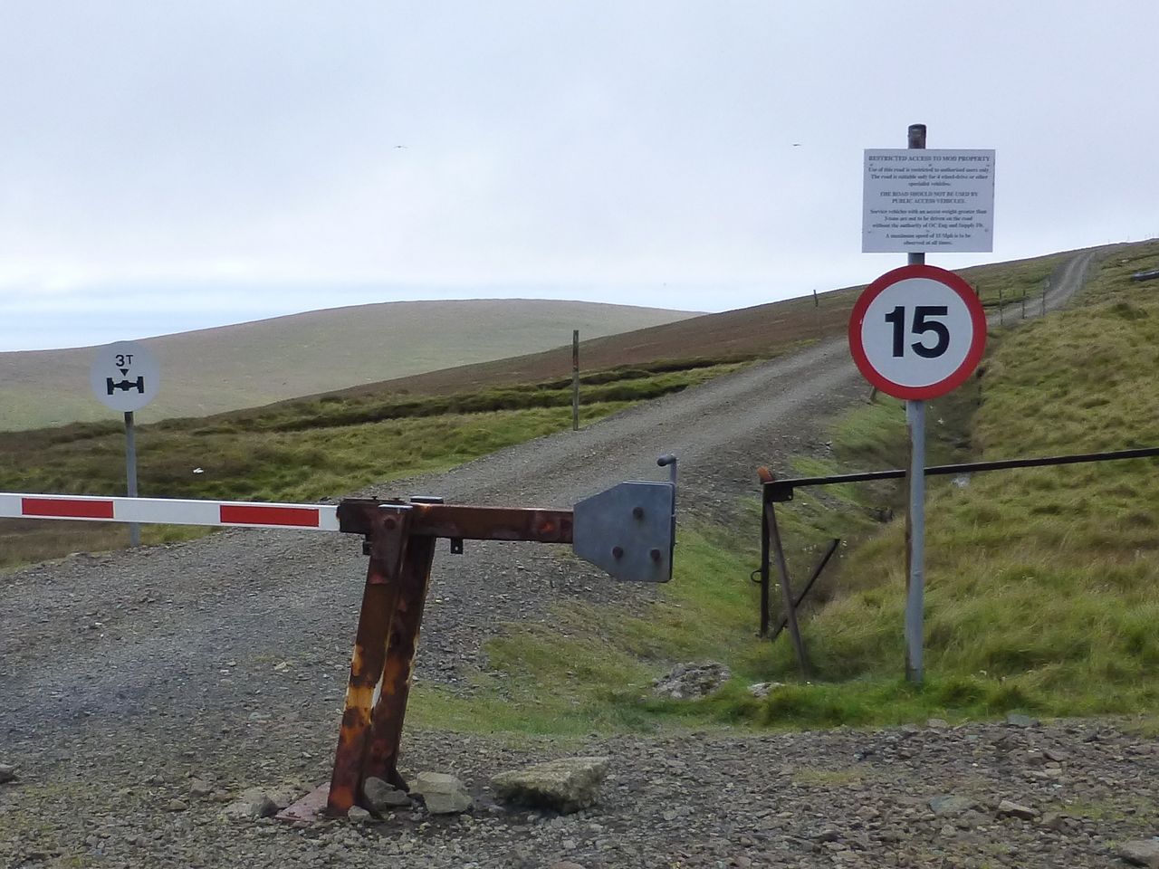
As we approached the hill of Saxa Vord it rose up before us, far too steep for wimps, so we pushed the bikes a good way over it, passing a Ministry of Defence sign on the way which said 'No Unauthorised Persons… etc'. The RAF radio installation there has been moth-balled since 2006, however, so we ignored the sign and carried on regardless.
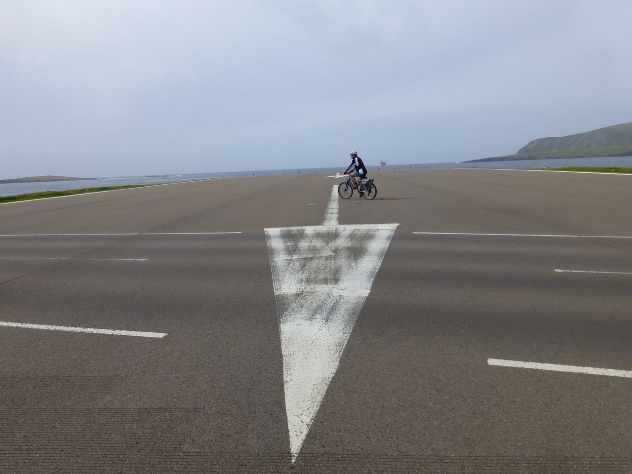
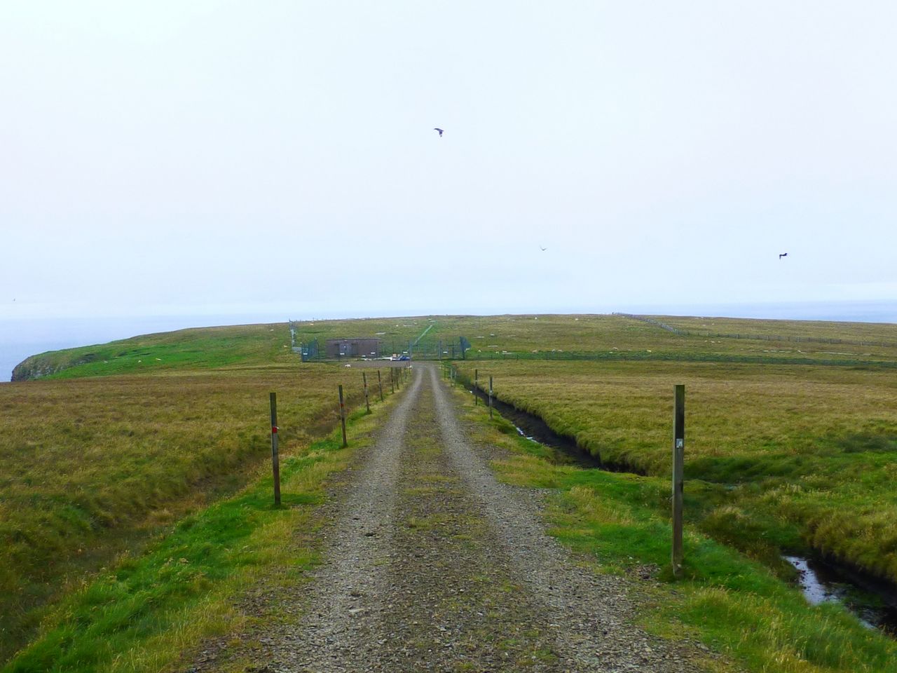
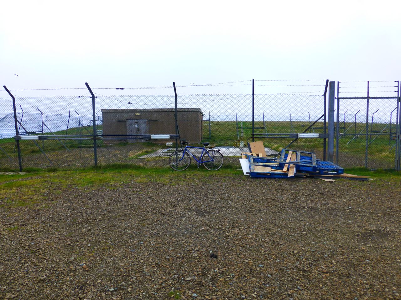
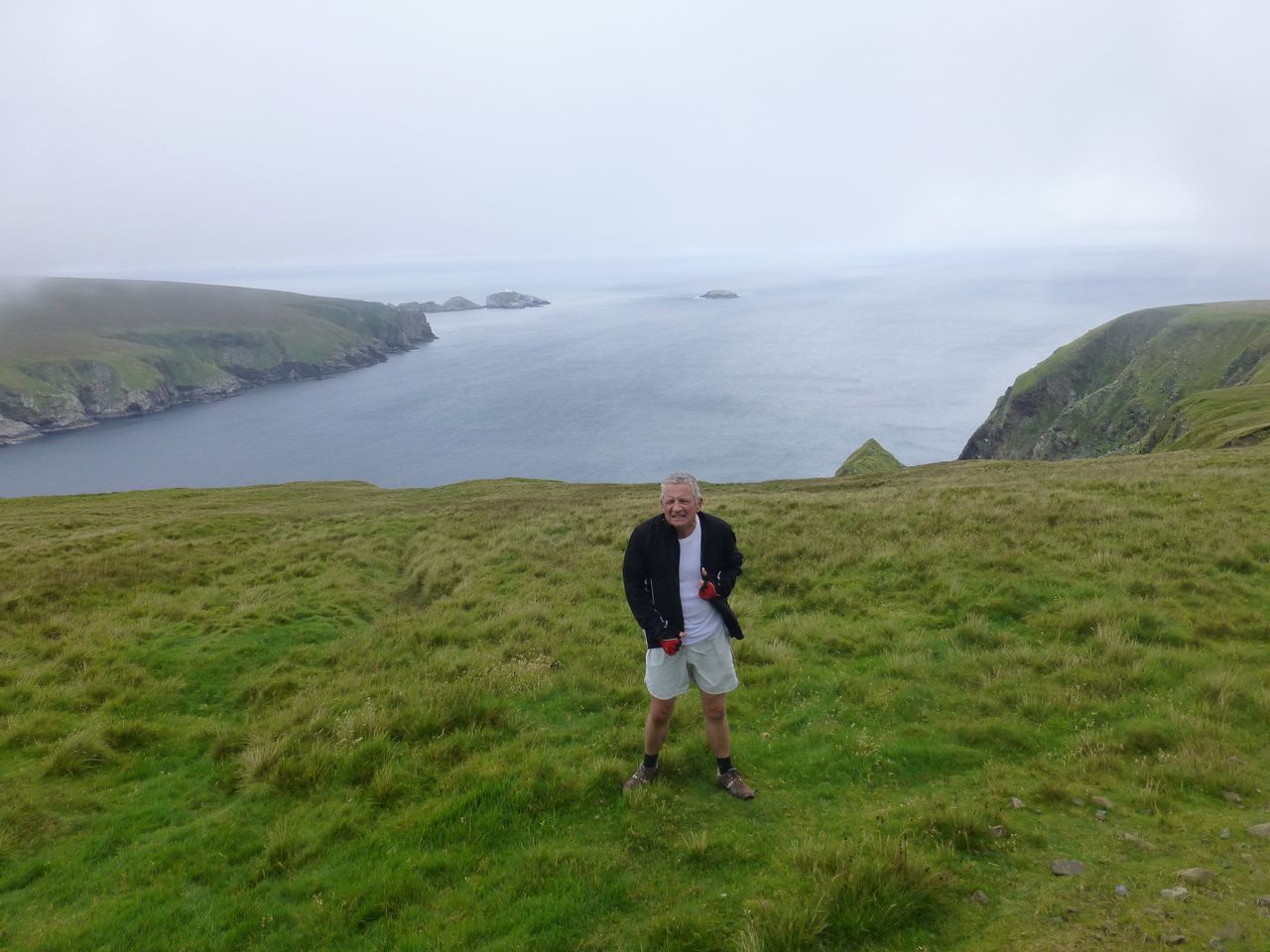
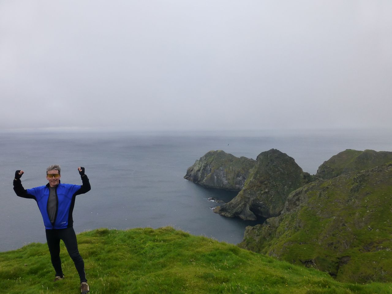
Near the top of the hill the road forked with the right-hand route heading off to the RAF site and the other route heading to … the end of the UK! We took the left-hand route but it was a rough track with sharp stones so we continued pushing most of the way, worried about possible punctures, even though it was now heading downhill. I rode bits of the way where it looked better but Andrew pushed for a while then decided to leave his bike and continue to the end on foot. I wanted to take my bike to the absolute end though so I carried on to the spot where the Last Road finishes. There was a squat, grey utility building there, surrounded by a wire fence and with some bits of scrap wood dumped beside it.
We took some photos then carried on on foot to the final cliff edge. Bonxies were flying around overhead, eyeing us up, but as it wasn't the breeding season they didn't actually attack. The islet of Muckle Flugga nestled in the waves nearby, topped by a lighthouse.
Well we'd done what we came to do so we turned round and made our way back up the hill through the low cloud then rode back to the hotel to pick up the luggage. There was low cloud about and an increasingly strong wind and it was hard going getting back to Belmont for the ferry.
At Gutcher we had some lunch at the café but I wasn't able to finish it - for some reason I can't eat much when exhausted. Crossing the subsequent 18 miles of Yell was really hard work, battling into the wind which was joined by a fine rain which became heavier as we progressed. Progress was painfully slow.
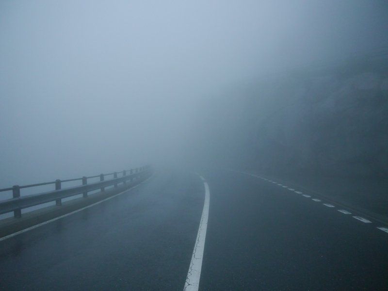
By the time we reached Ulsta we were extremely cold, wet and knackered. We had a hot chocolate drink from a dispenser in the shop there while we waited the half an hour for the ferry. The ferry left at 17.30 and took about 20 minutes to get to Toft. The final stretch of that day's ride, the 9 miles from Toft to Brae, was absolutely miserable. In fading light the rain came down stronger and stronger, cold legs found the going harder and harder and there was heavier traffic near the airport and Sullum Voe, the oil terminal. It had become too wet to take photographs of our ordeal but these photos lifted from the internet give some idea of the conditions.
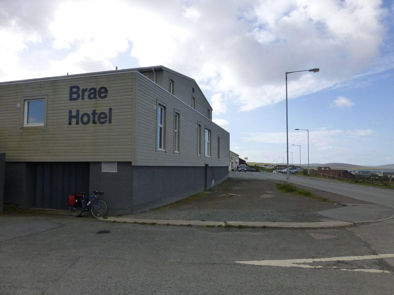
Finally we got into Brae; the first hotel we came to was naturally not ours. Ours, the Brae Hotel, was ľ mile further on and up a hill. It was 19.30 when we got there and last orders for food were 19.45 although the chef agreed to stay late for us. Even so we managed a quick shower and got down to the restaurant in time. The only vegetarian option on the menu was Caesar salad but we asked for an alternative and chose samosas for starters and spicy beanburger main meal. I ate the samosas but although I'd been really hungry from all the energy used up today I could barely eat a quarter of the main meal. It wasn't very nice - bun dry, the rest fairly tasteless - but that wasn't the reason. My body wouldn't take it - metabolism shaken up by digging too far into reserves.
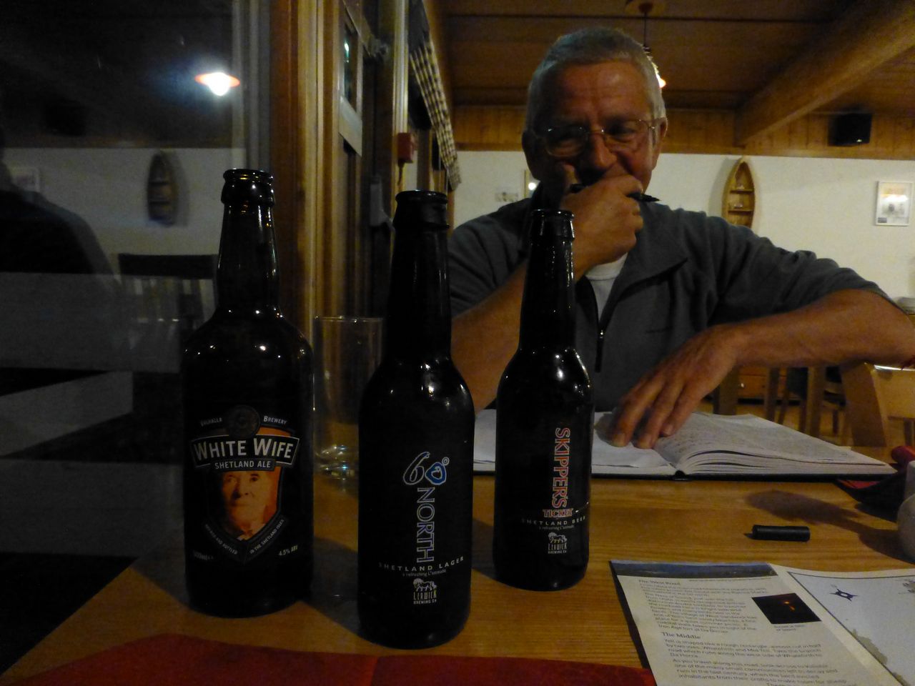
After dinner we had a snooze then about 10.00 Andrew wanted to go out for a drink. I didn't really want one but got ready while he said he'd meet me in the bar. A minute or two later he was back, describing it as a complete animal house with people, mostly young, yelling and shouting and swearing. We skipped that and walked down the road to the Mid Brae Inn only to find that that was exactly the same - roaring from within and a tattooed mob standing smoking by the door. So we had to walk the ľ mile back to the first hotel we'd seen on entering the village, a new one called the Moorhouse Hotel. Thankfully this was fine but by now it was 10.45 and the bar was closing in quarter of an hour. We went in and while I had an apple and mango J2O Andrew had a pint of water and three pints of an ale from Unst, a product of the Valhalla Brewery which we had passed by earlier in the day on our way up to The Noup. Stats for the day: GPS: 54 miles 5.8 mph average speed 39.9 mph max speed 4353 feet of ascent Bike computer: 48 miles 7.2 mph average speed Saturday 31st August 2013 - Brae to Lerwick Today was a lot better than the truly dismal latter half of yesterday. We woke up to patches of blue sky and white clouds and it stayed like that, pretty much, apart from an odd shower or two. The wind was still quite fresh but not as bad as yesterday and sometimes it was in our favour, particularly on the climb up the last hill before Lerwick where it pushed us up a bit. The road was generally a lot less hilly than the previous day's but there were no tea-shops along the route.
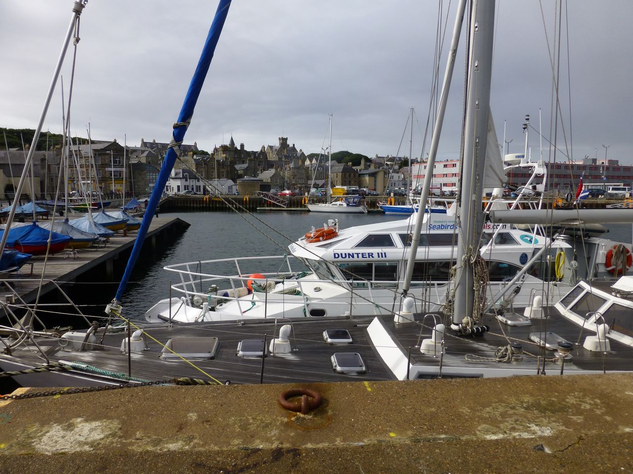
When we got to Lerwick we called in at a café and had a lentil soup and bread each, and a cup of tea. I then went off to the centre for an hour shopping for souvenirs then met up with Andrew again for a mooch around the Shetland Museum before riding to Holmsgarth port and embarking on the MV Hjaltland for the overnight trip back to Aberdeen - sets off 19.00 and gets there 07.00 on Sunday. At least the town centre should have less traffic about at that time than when we passed through on the journey out.
It was quite a rough crossing with great pounding whacks as the ship descended onto each rising wave causing the whole structure to shudder. It's a wonder those ships survive the beatings they take on a regular basis. Still all was well and we got to Aberdeen on time early on Sunday morning, rode to the car park and the car was there, safe and unscathed, ready to take us home. Stats for Brae to Lerwick: GPS: Figures went awry Bike computer: 22 miles | |||||||||||||||||||||||||||||||||||||||||||||